
July 30 became a historic day for India and the whole world, when NASA and ISRO joint project NISAR (NASA-Isro Syntic Aperture Radar) satellite was successfully launched. The launch took place at 5:40 pm from Satish Dhawan Space Center in Sriharikota, Andhra Pradesh, which is being seen as a big jump in India’s space science.
Nisar satellite made in partnership between ISRO and NASA
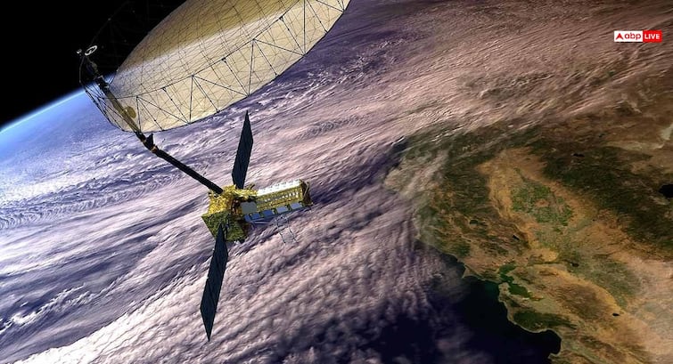
NISAR i.e. Nasa-Isro Syntic Aperture Radar is a special satellite, which is prepared by ISRO of India and NASA of America. Its purpose is to inspect the surface of the earth very closely so that the complex processes on our earth can be understood. This satellite will monitor the changes in the forests, the breakdown of snow sheets, the rise of sea level, lack of ground water and natural disasters.
Even 1 centimeter change in the surface of the earth will be able to catch
Nisar’s radar is the first device of its kind in space in terms of technology, which will work very accurately. It will scan the surface of the entire Earth in a systematic way and will also measure such changes that will be equal to only 1 centimeter. This means that this satellite can already indicate us of natural disasters and can be warned in time.
#Watch Nasa-Isro Nisar Satellite Onboard GSLV-F16 Launched from Satish Dhawan Space Center (SDSC) in Sriharikota, Andhra Pradesh
Nisar, or nasa-isro synthetic aperture radar is a joint venture of isro and nasa and has been designed to provide a detailed View of the earth to… pic.twitter.com/cx942pcuffj
– ANI (@ani) July 30, 2025
Mission NISAR characteristics
The NISAR mission jointly developed by Space Agencies ISRO and NASA of India and the United States is the first satellite mission of its kind. This satellite uses advanced sweep SAR technology, which is capable of taking pictures of broad area with high resolution. NISAR was launched by GSLV rocket from Sriharikota at Sun-Synchronous Polar Orbit, which is the first mission of GSLV in this class.
After the launch, the first 90 days will be held in commissioning or in-orbit checkout (IOC). This satellite will provide 3D photos of the land and ice of the Earth, which will help scientists a lot of earthquakes, landslides, sea ice and glaciers monitoring, crop management and disaster warning system. This satellite will also play an important role in policy and planning to deal with governments to deal with natural and human-related dangers. The NISAR, NASA and ISRO launched by now is the most advanced radar system, which will provide large amounts of data on a daily basis.
Configuration and operation of spacecraft
The NISAR spacecraft is based on the I-3K structure of ISRO and includes two major payloads-L-band and S-band synthetic aperture radar (SAR). The S-band radar system, data handling, high-speed downlinks, spacecraft and launch system have been developed by ISRO, while L-band radar, GPS receiver, solid-set recorder, 12 meter reflector and 9 meter boom have been provided by NASA.
ISRO will take over the command and operation of the spacecraft of this mission, while the NASA Orbital Operations and Radar Operation Scheme will be provided. Ground stations of both ISRO and NASA will be used for data obtaining and processing data. L and S-Band SAR data obtained from the same platform will give scientists accurate information in understanding the subtle changes happening on the Earth’s surface.