
 By Admin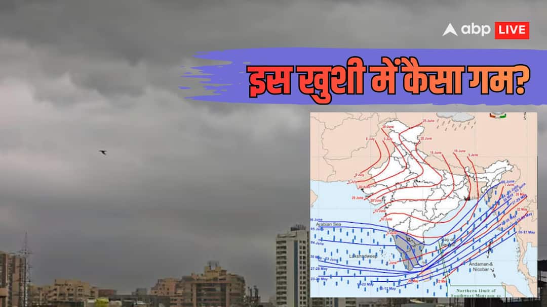
On July 9, 2026, the south-west monsoon covered the entire country. This date was delayed by just one day from July 8. This was the slowest extension of the monsoon since 2021, when it reached the entire country on July 13. But a warning has also come with this news. IMD said that the active period of monsoon is now ending and the rainfall will reduce again from July 15. Why will the rains reduce and what will happen next…
When and how did monsoon cover the entire country?
Monsoon entered Kerala on June 4 this year i.e. three days late from June 1. After this, the pace of monsoon remained very slow for about two weeks. June 2026 was the fifth driest June in 126 years. Between June 1 and 30, the country received only 99.5 mm rainfall, i.e. 40% less than normal. But in the first week of July the monsoon made a strong comeback. Between July 1 and 8, the country received 42% more rainfall than normal. At this fast pace, the monsoon completed its expansion across the country on July 9 by covering the remaining parts of Rajasthan, Haryana and Punjab.
This was the slowest expansion since 2021, but historically this is not unusual. Since 1971, monsoon has covered the country anytime between 16 June (2013) to 15 August (2002).
How much rain did it rain and how much was the loss?
Between June 1 and July 9, a total of 205 mm rainfall occurred in the country. Whereas the general average of this period is 233.1 mm. That means till July 9, there was 14% rain deficit in the country. For comparison, let’s see how much improvement happened:
| date | rain loss |
| 30 June | 40% |
| 7th July | 17% |
| 9th July | 14% |
Meaning, in just 9 days the rain deficit reduced from 40% to 14%. However, the territorial distribution has been very uneven:
- East and North-East India: 38% decrease
- Bihar: 53% reduction
- Jharkhand: 43% reduction
- Punjab: 37% reduction
- Uttar Pradesh: 27% reduction
- South Peninsula: 15% reduction
- North-West: 9% decrease
In contrast, Madhya Pradesh, Maharashtra, Gujarat, Chhattisgarh and Odisha received 3% more rainfall.
What warning has IMD given?
The biggest news is that the active period of monsoon is now ending. IMD Director General Mrityunjay Mohapatra clearly said, ‘The active phase is now over. The rain will gradually reduce from July 10 and will remain like this for the next two weeks.
OP Sreejeet, IMD scientist and head of the Climate Monitoring Group, also reiterated the same thing, ‘Due to the northward shift of the monsoon trough, rainfall activity will start reducing from July 10. We can expect below normal rainfall in the country from July 15.
Which states will be most affected?
There will be very less rainfall in Delhi, Haryana, Punjab, Rajasthan, Gujarat, Maharashtra, Madhya Pradesh, Chhattisgarh and Telangana for the next 5-7 days. Rain will continue in Uttarakhand, Himachal Pradesh, Bihar, West Bengal, Sikkim and Northeast.
IMD had already predicted below normal (less than 94%) rainfall for July 2026. For the entire monsoon season (June-September), IMD has predicted 90% of normal rainfall, which is due to El Nino.
Is 14% rain deficit dangerous?
The deficit of 14% falls under IMD’s ‘normal’ classification. According to IMD, 19% less to 19% more rainfall than normal is considered ‘normal’. However, if the rainfall is reduced by 20% to 59%, then it is called ‘deficient’. If there is a deficiency of 60% or more, then it comes in the ‘scanty’ category.
Meteorologists declare drought when seasonal rainfall in an area is less than 75% of normal. It is further divided into two categories:
- Moderate Drought: 26% to 50% reduction
- Severe Drought: More than 50% reduction
What has been the impact on Kharif crops?
The delay in monsoon and drought in June has had a direct impact on the sowing of Kharif crops.
- So far sowing has been done in 350.85 lakh hectares.
- 91.95 lakh hectares less sowing compared to last year
- Soybean and cotton have been most affected
Union Agriculture Minister Shivraj Singh Chauhan said that farmers have been advised to sow low water crops like maize, millet and moong. The government has prepared a national seed stock of 1.75 lakh quintals. 262 sensitive districts are being monitored.
Why the slowest monsoon after 2021?
There were three major reasons for the delay this year:
- Weak cross-equatorial winds, which bring the monsoon
- Lazy monsoon trough, which is necessary for rain
- Strong El Nino, which weakens the monsoon
IMD says that rainfall will reduce from July 10 and will become below normal from July 15. What does it mean:
- While the deficit reduced from 40% to 14% in a week, this deficit may increase again due to less rainfall in the next two weeks.
- This will be a challenge for Kharif crops, especially in areas where there has already been less rainfall.
- The water level in the reservoirs is lower than last year.
- S&P Global Ratings has warned that a weak monsoon could impact rural demand, agricultural income and inflation.
However, one ray of hope is that there is a possibility of rain again in late July.
What is the real picture of the weather?
- Good news: By July 9, monsoon covered the entire country. Losses reduced from 40% to 14% in a week. There was good rain in Central India.
- Worrying news: Rain has been decreasing since July 10. ‘Below normal’ rainfall is expected from July 15. There is a shortage of 38% in Eastern India. Kharif sowing is less by 92 lakh hectares. The threat of El Nino still persists.
IMD says that the deficit of 14% is currently in the ‘normal’ category, but due to less rain in the next two weeks, this deficit may increase again.